

From Evermade
Jenni Sparks A1 Hand Drawn Map Of London Print
$182.49
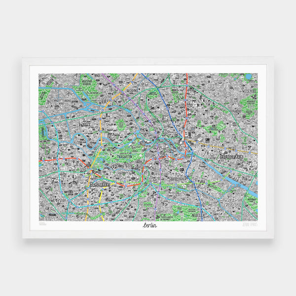


In collaboration with illustrator Jenni Sparks we present the definitive culture map of Berlin. This hand-drawn map of Berlin meticulously highlights the diverse cultural landscape of the city. The map is brimming with the quirky in-the-know hallmarks, landmarks and local haunts. Not only is the map a design must-have, it also provides a handy reference point as it is based around local public transport links.
Not Your Typical Map The map is densely packed with hundreds of illustrations representing both well known facts and new discoveries about Berlin. Jenni’s bold and humorous style of illustration brings each Berlin neighbourhood to life - featuring Sunday markets, bars, parks, along with tidbits of local history.
Areas Covered
The map covers the areas of Berlin that you’d expect; it goes as far north as Wedding and Volkspark Rehberg. The south covers all areas up to and including Viktoriapark, Treptower Park and Wilmersdorf. The east of the map goes as far as Friedrichshain, Pankow and Weisensee. The most western parts of the map are Charlottenburg Nord, Flughafen Berlin Tegel and Charlottenburg. Of course, it also covers Tiergarten, Mitte, Moabit, Schöneberg and Kreuzberg.


